
Park Forest Neighbor Record Sources
A block lookup combines separate public sources. GIS shows which parcels are next to one another. Assessor data describes each parcel, and recorded documents identify legal interests. Village programs show civic areas and public contacts. None of those sources is a complete roll of Park Forest neighbors, renters, children, guests, or other household members.
| Source | What it shows about a block | Access and limit |
|---|---|---|
| CookViewer | Parcel outlines, intersections, PINs, and map context | Search by address, PIN, or intersection; no verified radius export |
| Will County GIS | Parcel context plus base, aerial, land-use, and public-safety layers | GIS office and map gallery are the fallback when the live viewer fails |
| County assessors | Parcel class, values, features, and public owner or tax fields | Cook address/PIN modes; Will also has owner search |
| County recordings | Deeds, mortgages, liens, document dates, and legal descriptions | Search each parcel; copies or images may cost |
| Village permits | Public improvement, inspection, or code activity by address | Record-number search or a focused request; no full public index |
| Neighborhood programs | Meeting area, zone, and official contact route | Civic geography only, not a member roster |
| Historical directories | Past names tied to a house or street in selected years | PFPL, PFHS, and digitized regional books |
Use the table as a proof ladder. A parcel outline proves adjacency at the map's date. An assessor result ties facts to the parcel. A deed names recorded parties. A meeting notice only shows that an area was invited. State what each source establishes instead of calling every owner a current neighbor.
Map Park Forest Neighbors by Parcel
On the Cook side, CookViewer accepts a street address, intersection, or PIN. A matching Property Results item zooms to the parcel. Clicking the shape opens details; panning one parcel at a time reveals the actual shared boundaries. The map matters more than the next street number because a corner lot can touch three streets, and a condominium may put several units on one parcel.
- Search the known address, then confirm the city, county, and parcel shape before recording any name.
- Save the target PIN, situs label, legal description, source date, north arrow, and map scale.
- Click each parcel that touches the target. Keep a separate row for every PIN and do not merge shared drives or skipped numbers.
- Open the county assessor record, then use the recorder only when a deed or legal-interest check is needed.
- Use the Village permit and civic routes for block context. Move to the Park Forest street directory for a whole named street.
This creates a traceable flow: address to map, map to adjacent PIN, PIN to assessor, assessor to recorded document. Save the date. Boundaries and ownership can change after the map image was made.
Will County Neighbors Need a Fallback
The Will County GIS Division describes more than 70 layers, including base, aerial, land-use, hydrology, agriculture, and public-safety material. The live Data Viewer returned an error during research. Use the Division page, map gallery, or mapping staff instead of implying that an adjacent-parcel tool was verified.
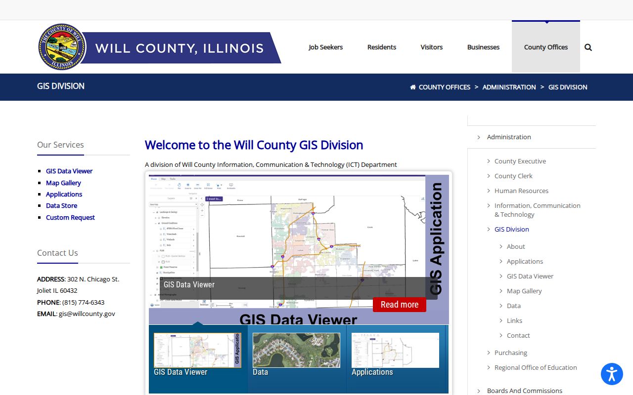
The captured GIS page points to the official map and staff routes that remain available when the interactive viewer cannot be reached.
Will's assessor portal accepts full or partial PIN, street address, sale data, subdivision, owner name, and property class. Address mode allows partial street-number, street-name, and city text. The result is supplied as a courtesy from township assessment data, so use the Recorder's grantor-grantee index for recorded ownership evidence. Park Forest parcels in Will County can involve Crete or Monee township codes.
Note: A Park Forest postal label does not decide the county; confirm the parcel before choosing Cook or Will records.
Park Forest Neighborhood Meeting Areas
The Village Neighborhood Meeting program began in 2004 and rotates leadership meetings through parts of town. Residents in a selected area receive mailers. A 2024 notice said Area E, Area J, Garden House, Juniper Towers, and Legacy Square were represented, with nearly 900 addresses invited and about 40 attendees. Those numbers describe outreach, not a household directory.
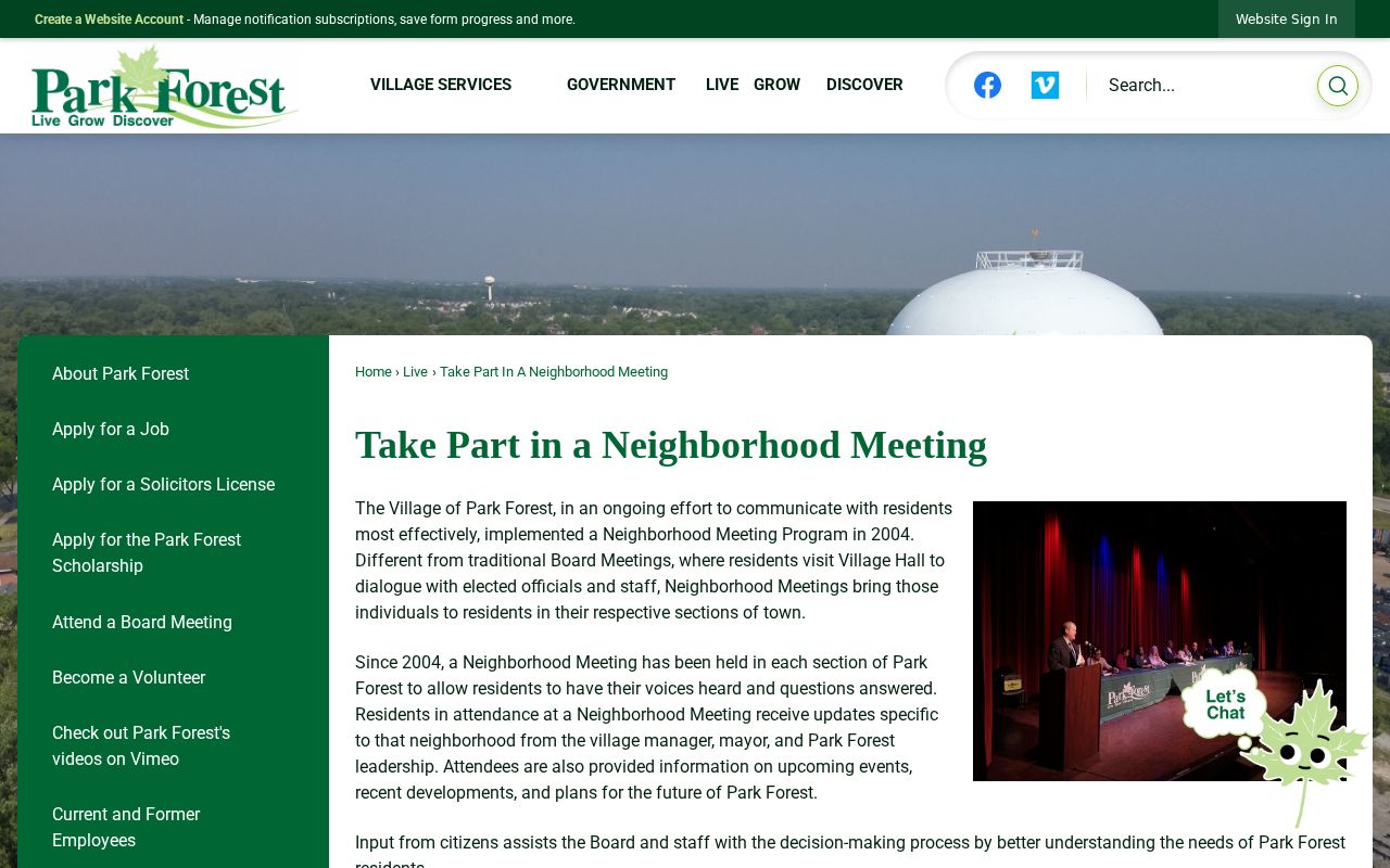
The meeting page supplies a public route for learning which civic area serves an address while keeping attendee and resident rosters private.
A January 2026 Village notice adds the POP neighborhood program, with a dedicated officer assigned to each zone for non-emergency contact. Ask Village Hall which zone covers an address. The program may connect Park Forest neighbors with the right public contact, but it does not identify residents on a block.
Park Forest Neighbors and Civic Groups
Community organizations add local knowledge that parcel records cannot supply. The Village Clubs and Organizations directory gives public contact routes. Member lists remain controlled by each organization. Two documented groups also carry long local histories: the Garden Club of Park Forest was founded in 1954, and Friends of Thorn Creek Woods formed in 1969 to support the preserve.
Village civic directory
Use the official category and contact listing to reach a group. It is not a Park Forest neighbor roster.
Neighborhood meetings
Village Hall can identify the meeting area or zone tied to an address and explain the next public meeting.
PFPL Adult Services
Call 708-748-3731 for historic street files, local newspapers, maps, and directory help.
Historical Society
Contact the PFHS archive for organization files, maps, photographs, oral histories, and older address context.
A private neighborhood association presence was found, but no official townwide HOA registry or coverage map was verified. Do not assume one group covers every Park Forest parcel. Ask the organization directly about its boundary and access rules, and never copy a private resident directory into a public block list.
Park Forest Block Activity Records
Building and code records can show activity at nearby parcels. The Park Forest municipal records portal lists detailed records, utilities, business licensing, and payment services. Its Building Department search begins with a permit, enforcement, certificate, PZE process, or invoice number rather than a broad block browse.
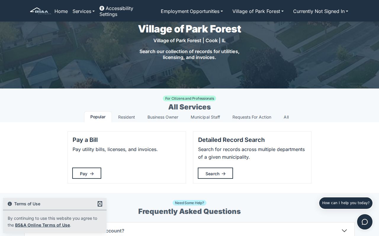
The portal image shows why a known record number helps; without one, a focused Building Department or FOIA request is the better access channel.
Ask for a precise street address, type of permit or code record, date span, and electronic format. Permit data may name an applicant, contractor, or owner, but none automatically proves who occupied the parcel. A Village budget notes that BS&A supports permits, inspections, code actions, and street-by-street maintenance work, yet no complete public case roster was verified.
Voter Data Is Not Neighbors List
Illinois provides an individual registration lookup requiring first name, last name, birth date, and ZIP, with a later address-confirmation step possible. It is not a browse-by-block tool. Statewide computerized voter files are restricted under election law to eligible political users and purposes. No public Park Forest street-level voter download was found.
That makes voter data a narrow confirmation for a person who supplies the needed facts, not a source for discovering every neighbor. Registration may be absent, stale, or protected. Ballot choices are not public. The Illinois Address Confidentiality Program also supplies a substitute address to eligible survivors, though it cannot erase property records created earlier.
Official Park Forest Block Evidence
Commercial neighbor tools can merge old occupants, marketing files, and unrelated people. They may look fast, but the result can be stale and the source date unclear. Official records take more work because each one answers a smaller question. That narrower scope makes errors easier to find.
| Method | Strength | Main caution |
|---|---|---|
| Official parcel and deed trail | Named custodian, parcel key, document date, legal description | Owner is not always an occupant |
| Village civic and permit route | Local program, public contact, address-specific activity | No complete resident or permit roster |
| Commercial compiled tool | Broad category search | Unknown merges, old names, missing protected people, and unclear update dates |
For personal safety or neighborhood curiosity, preserve the official URL, PIN, legal description, and date. If records conflict, ask the custodian instead of choosing the most convenient name.
Privacy for Park Forest Neighbors
Parcel files do not list each person inside a home. Utility customers, delivery records, DMV addresses, protected voter details, private club rosters, and visitors remain outside the public block layer. A tax mailing address may also belong somewhere else. Describe a named party as an assessor-listed taxpayer or a deed party, with the date, rather than claiming that person lives there now.
The Village demographics page confirms Park Forest's two-county setting and broad community context.
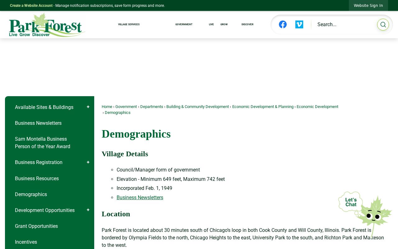
That boundary context explains why two homes that seem close may route to different county assessors, recorders, courts, or election offices.
When a source names someone, write down the record type beside the name. “Owner on a dated assessor record,” “grantee on a deed,” and “public contact for a civic group” are precise descriptions. “Lives next door” is a claim those records may not support. Recheck a parcel after a sale, and confirm a recorded instrument through the county office when accuracy matters. If an address appears protected or a custodian removes a field, stop there. A nearby parcel, old directory entry, or social connection should never be used to defeat a lawful privacy safeguard.
Lawful use. Use Park Forest neighbor records for civic contact, property curiosity, or personal safety. Never watch, intimidate, harass, or harm anyone.